How do you protect a coastline of 1,600 kilometres when you don’t know where it will give way next? That is the challenge Colombia has been facing along its Caribbean coast. Here, erosion is altering the structure of local communities, infrastructure and livelihoods, but the data to predict where and how fast it will advance has long been out of reach. Through IPDC, Colombia and the Netherlands have developed a large-scale model that shows where the coastline is most at risk – giving policymakers and communities a scientific basis for deciding where to act first.
Planning ahead for a coastline under pressure
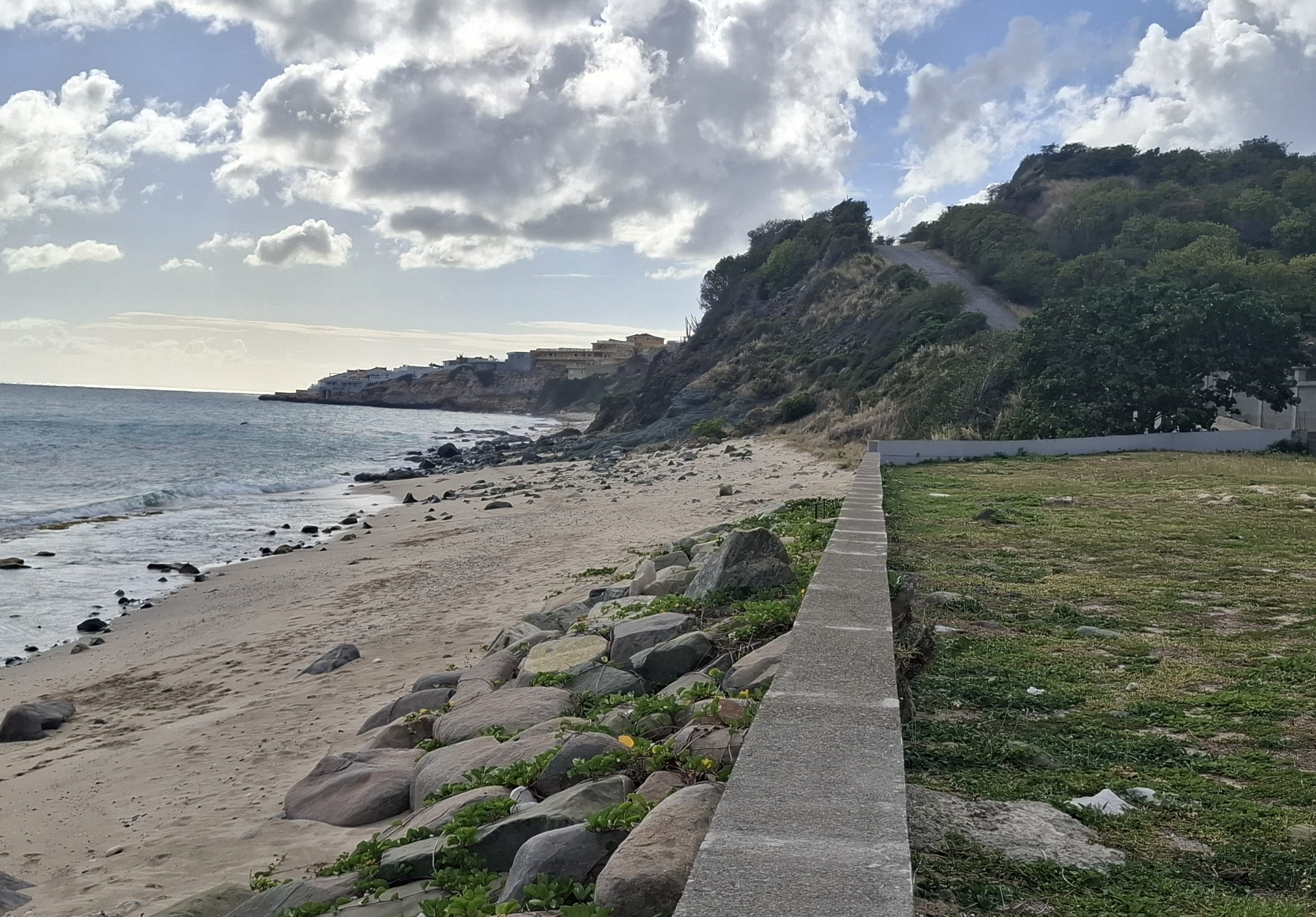
Colombia’s Caribbean coast is not only one of the country’s most ecologically rich regions but also one of the most vulnerable to coastal erosion. The communities living here face significant socioeconomic challenges and have limited means to absorb the impact of coastal change. Climate change is making that exposure worse: rising sea levels and shifting wave patterns are accelerating erosion along stretches of coast, pushing the people closer to the edge.
The government of Colombia has already taken important steps. A 10-year Coastal Management Plan established a clear framework for protecting the country’s coastline. But without region-wide information and reliable predictive tools, translating it into action proves difficult.
Solving the knowledge gap
To address this information gap, the project developed a set of forecasting tools for the southern Colombian Caribbean, with a clear long-term objective: to equip Colombian authorities with the knowledge, methods and tools needed to lead this work independently in the future. The project provides authorities, communities and local partners with clear, practical information to support better coastal decisions today, while building the technical capacity to keep improving those decisions over time.
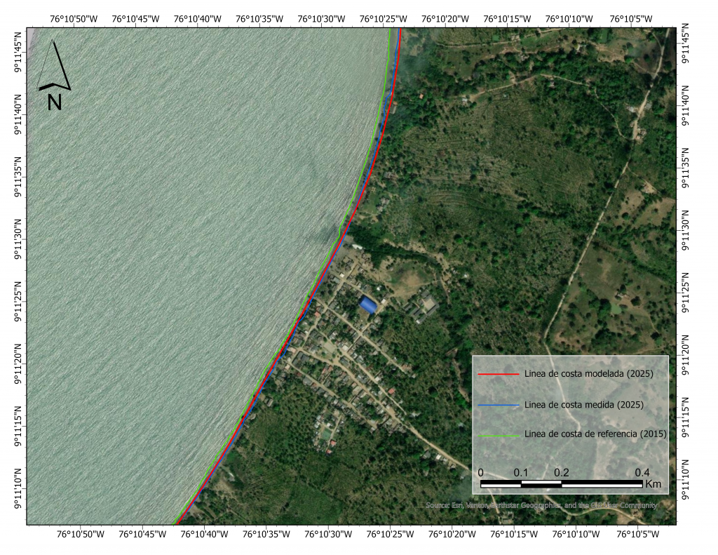
A central part of the work is developing two linked open-source models – SnapWave, which models wave conditions across the entire southern Caribbean, and ShorelineS, which simulates how individual erosion hotspots will evolve over time. Santander de la Cruz is the current priority site not only because of its urgency, but also as a learning location where methods are tested, refined and transferred so Colombian institutions can apply them in other hotspots as data and resources become available.
Once the past has been modelled, the team can simulate future scenarios to show how the coastline will change under different conditions. This allows authorities to explore the potential impact of different adaptation options, such as beach nourishment or hard structures, and future scenarios such as sea level rise to identify where interventions are most needed.
Results are published through a public visualisation platform linked to Colombia’s national coastal monitoring system. There, authorities, communities and partner organisations can explore future shoreline changes and expected outcomes under different adaptation options.
The model was developed by Invemar, Deltares, IHE-Delft, and DAMCRA from The Ministry of Environment and Sustainable Development. IPDC played a central role in connecting international expertise with Colombian institutions and academic partners to support evidence-based decision-making.
Involving citizens
Involving citizens is essential because one of the biggest technical challenges is obtaining reliable measurements of coastline position over time. Frequent, comparable observations are hard to collect along long and remote stretches of coast, and satellite imagery alone often misses local detail needed to interpret change correctly. To close this gap, the project developed a citizen participation system that lets people upload location-tagged photographs via a mobile app, creating repeated observations that strengthen time-series data and improve model calibration.
Citizen input is also critical for identifying non-erodible locations, such as rocky or otherwise hard coastal sections, which behave very differently from sandy stretches and must be represented correctly in the models. IHE-Delft built the platform and trained local authorities to manage it, helping them collect and analyse these data while strengthening local engagement and long-term monitoring capacity.
From model to policy
The modelling work feeds directly into Colombia’s Coastal Management Plan and Coastal Erosion Master Plan, providing the predictive basis that was previously missing. It also aligns with the country’s National Risk Management Plan.
“Citizens and public authorities will have access to the same information on potential future shoreline erosion risks, which will allow open and transparent discussions between them on the needed actions and management strategies.” – Marta Faneca Sanchez, IPDC project coordinator
Lessons for other coastlines
Colombia now has data-driven estimates of where its coastline is most at risk. It is not a final answer, but a stronger basis for decision-making than was previously available. The project is designed so that Colombian institutions can continue updating and using these tools independently, long after this stage ends. The challenges Colombia faced along its Caribbean coast are ones many coastal countries will recognise. Other countries dealing with similar erosion pressures can build on what this project has started.
Want to know more about IPDC support in Colombia and the work on the Caribbean coastline? Get in touch with Marta Faneca Sànchez at Marta.FanecaSanchez@deltares.nl.