Climate change impacts are increasingly visible across the Caribbean. To support informed decision-making and concrete action, climate impact atlases have been developed over the past two years for the islands within the Kingdom of the Netherlands.
The atlases bring together current and projected climate impacts at island scale. They are designed to support informed decision-making by governments, professionals, educators, and communities. They are used as key inputs for the development of national climate adaptation strategies and for raising awareness about climate change.

What the atlases offer
Each climate impact atlas centralises existing knowledge on climate change impacts specific to the island. All information is freely available and presented in a user-friendly way.
The atlases include interactive maps, detailed map explanations, climate stories, climate statistics, and mind maps of climate impacts. Together, these elements provide both analytical insight and real-world context, helping users understand where climate impacts occur and why they matter.
Accessible and usable climate data
The atlases include interactive maps showing risks such as flooding, drought, and heat, combined with information on ecosystems, land use, and critical infrastructure. Clear map explanations help users understand what the maps show and how they can be used to inform action.
In addition, the atlases contain climate statistics that describe expected changes in temperature, rainfall, wind, and sea levels. These statistics were developed together with local meteorological offices to ensure scientific quality and local relevance.

The image shows the vulnerable buildings and accessibility of roads during an extreme downpour rain shower for Philipsburg, Sint Maarten.
Stories and local perspectives
Data alone does not fully capture how climate change affects daily life. Each atlas therefore includes climate stories written by local authors. These stories describe lived experiences of climate impacts and explore possible solutions in an engaging and accessible way. They are intended for a broad audience, regardless of age or educational background.
In addition, participatory workshops were held on each island to identify and structure climate impacts across sectors. Impacts range from loss of cultural heritage to higher mortality. The results are presented as mind maps that are openly available.

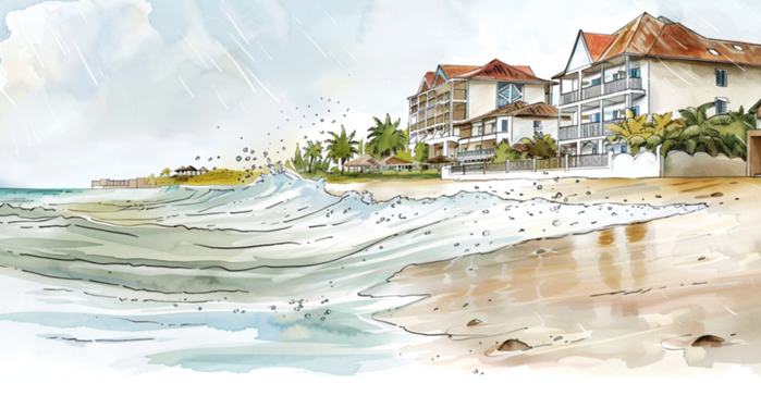
An example of one of the stories about sea-level rise for Curaçao.
Language and accessibility
The atlases are available in the languages most commonly spoken on each island: Papiamentu, Papiamento, Dutch, English, Spanish, and French. By offering multiple formats and languages, the atlases allow people to engage with climate information in a way that suits them.
More than 100 contributors from government, knowledge institutions, civil society, and the private sector were involved in developing the atlases, strengthening local ownership and relevance.

An example of a map explanation for the local language Papiamento of Aruba.
Island-specific approaches
Curaçao: KlimaKòrsou
The climate impact atlas for Curaçao is known as KlimaKòrsou. It was the first atlas developed with IPDC support and includes a wide range of climate and impact data. The atlas is now used as a key input for the national climate adaptation strategy.
Aruba: strengthening resilience through the NCRC
The Climate Impact Atlas Aruba is part of the National Climate Resilience Council. Within this platform, government, businesses, civil society organisations, and knowledge institutions work together to strengthen Aruba’s resilience and national capacity to address climate change.
Sint Maarten: a cross-border perspective
The St. Martin Climate Impact Atlas was developed by the Ministry of VROMI of Sint Maarten in collaboration with the University of St. Martin and the Climate Adaptation Services foundation. The atlas covers the entire island, including both the Dutch and French sides, reflecting the fact that climate change does not follow administrative boundaries.
BES islands: aligning with climate plans
One climate impact atlas was developed for the three BES islands: Bonaire, Sint Eustatius and Saba. This atlas closely aligns with the development of the islands’ climate plans.
Funding and coordination
The atlases for Aruba, Curaçao, and Sint Maarten were funded by the IPDC and the atlases for the BES islands were funded by the Ministry of Infrastructure and Water Management.
The development of the atlases was coordinated by the Climate Adaptation Services foundation. “By facilitating collaboration and knowledge exchange between islands, we strengthened the overall quality and coherence of the atlases,” says Timo Kelder, IPDC coordinator for the Dutch Caribbean (Climate Adaptation Services).
Resources
Climate Impact Atlas Aruba
St. Martin Climate Impact Atlas
Climate Impact Atlas Bonaire, Sint Eustatius and Saba
Contact
For any questions, you can contact Timo Kelder, IPDC coordinator for the Dutch Caribbean at timo@climateadaptationservices.com